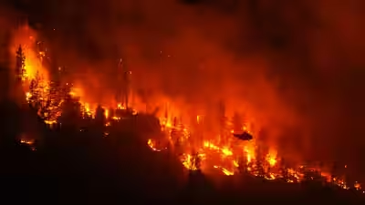
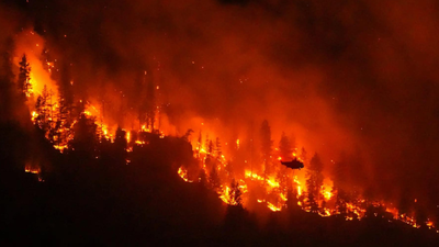
In July 2026, firefighters in southwest France watched something the country had never recorded before: a burning forest near Bordeaux, which manifested as a churning, anvil-shaped cloud, dark with smoke and crackling with its own lightning. It was a pyrocumulonimbus, a “fire cloud”, born when a wildfire burns hot enough to punch a column of superheated air into the atmosphere, cooling as it climbs until it collapses into a thunderstorm that feeds the very fire that created it. The gigantic wildfire ravaging southwest France created the phenomenon, never before seen in the country, according to the spokesman for the country’s National Firefighters Federation. Until then, France’s fire season had never produced anything of the kind. Fire clouds have historically been rare in Europe, showing up instead over Australia’s catastrophic 2019-20 bushfires and California’s 2020 wildfire season. Beyond France, the phenomenon has largely been confined to wildfire-prone Australia and North America. As French researcher Jean-Baptiste Filippi put it, the ingredients are simple and increasingly common: stormy conditions and fire occurring together, more often, in more places, as the planet warms.
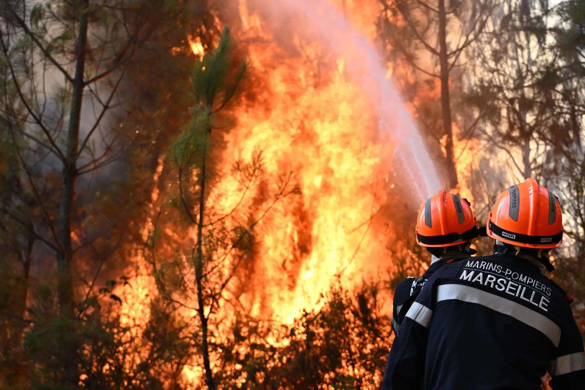
Weeks of extreme heat and drought had prepared the ground for France’s wildfire (PTI)
That question, whether a warming world is handing more places the ability to summon fire clouds of their own, inevitably turns toward India. The country’s relationship between climate change and forest fire is no longer theoretical. Rising temperatures, erratic monsoons and lengthening dry spells have already been pushing up the frequency of fires across India’s forest belt, which still covers 21.67% of the country’s land. Nearly 36% of that forest cover is now classified as prone to recurring fires, with Uttarakhand, Madhya Pradesh, Chhattisgarh and Odisha emerging as repeat hotspots in recent years. Globally, the pattern is stark: fire seasons have stretched by roughly 20% over the past four decades, and wildfires now account for close to a fifth of all land-use carbon emissions worldwide.So far, India has not reported a pyrocumulonimbus event. But as its dry seasons intensify and its forests grow more flammable, the question worth asking is not whether such a cloud is likely tomorrow — but what is standing between India’s fires and France’s sky.
What made France burn like never before
The wildfire that produced France’s first recorded pyrocumulonimbus began in the Gironde region in the country’s southwest, an area already several weeks into a punishing heatwave and drought. By the time the fire had been burning for two days, it had grown large enough that its own smoke column stopped behaving like smoke. At around 6.20 pm on a Friday evening, France’s departmental fire and rescue service confirmed what pilots and residents had already seen forming over the flames: a dark, anvil-topped cloud, generating lightning that struck the ground kilometres from the original fire and ignited new blazes of its own. The cloud weakened overnight as humidity rose, then reformed several times as the fire continued to burn.
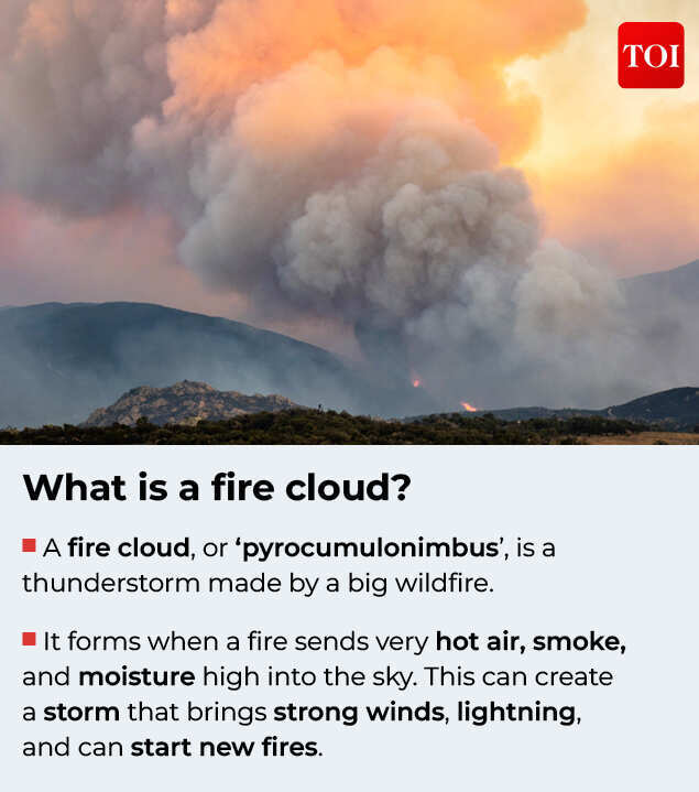
A fire cloud, or ‘pyrocumulonimbus’, is a thunderstorm made by a big wildfire.
For a country that has fought forest fires for generations, this was new territory. The French National Firefighters Federation called it a phenomenon never before seen in France. Researchers were careful to note that pyrocumulonimbus clouds, sometimes called pyroCbs, are not unheard of globally; they have been documented over extreme fires in Australia and Canada, and briefly over California’s 2020 wildfire season. But in Europe, and specifically in France, nothing on record had matched it.What makes the phenomenon rare enough to make headlines even in a summer of record European wildfires? According to Dr Kirti Avishek, associate professor at the department of remote sensing and geoinformatics, Birla Institute of Technology, Mesra, a fire cloud needs three conditions to align at once. “A pyrocumulonimbus forms when three things line up at once. First, an unusually intense, fast-moving fire is needed; one releasing enough heat to drive a column of hot air, smoke and ash straight upward, much like a chimney. Second, the atmosphere above the fire has to be unstable enough to let that plume keep rising rather than flattening out. Third, there needs to be sufficient moisture, from the burning vegetation itself and from the surrounding air, for water vapour in the rising plume to condense as it cools. That is what turns a smoke column into an actual cloud, and in extreme cases a thunderstorm-like structure capable of producing lightning.”It is this last requirement, moisture, that makes the phenomenon so counterintuitive. A fire cloud needs a landscape dry enough to burn ferociously, but wet enough, in the air above it, to build a storm. That narrow overlap, Dr Avishek’s explanation suggests, is exactly why the event near Bordeaux stayed a singular case rather than a recurring one, and why French meteorologists are still treating it as a first rather than a pattern.
The physics of a fire that makes its own weather
Most wildfires behave the way fire is expected to: they spread outward, pushed by wind and fuel, and mostly stay tethered to the ground. A pyrocumulonimbus event marks the point where a fire stops simply responding to weather and starts generating its own. Once a blaze becomes intense enough, the heat rising from it forms a column of superheated air, smoke and ash that behaves like a chimney funnelling straight upward. If the atmosphere above is unstable enough to let that column keep climbing, and if there’s enough moisture in the plume, drawn both from burning vegetation and the surrounding air, the rising smoke cools, condenses, and builds into an actual cloud. Pushed far enough, it takes on the structure of a thunderstorm.
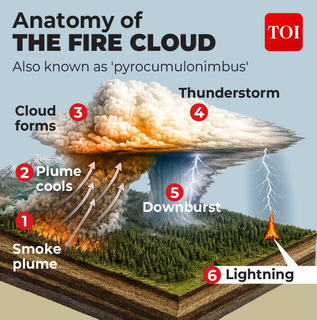
How a wildfire becomes a fire cloud
That is what makes the phenomenon dangerous rather than merely dramatic. A fully formed pyroCb can generate violent, erratic winds that redirect the fire below it without warning, and it can produce lightning capable of striking the ground kilometres from the original blaze, igniting fresh fires in places firefighters aren’t yet positioned to fight. In effect, the fire creates conditions that make it harder to contain, and sometimes lights the next fire itself.Because the phenomenon depends on this narrow overlap of extreme heat, atmospheric instability and just enough moisture, it has stayed rare, and until this year, geographically concentrated.
Where would India fit into this picture?
The country hasn’t recorded a pyrocumulonimbus event, but several of its forest regions already carry the underlying ingredients that make fires severe enough to test those thresholds. Central India, the Himalayan foothills, the Western Ghats and the Eastern Ghats have all shown rising vulnerability to forest fires, driven by dense forest cover combined with increasing climatic variability. Forest Survey of India data from 2000 to 2020 shows a steady climb in fire incidents, peaking in extreme drought years like 2009 and 2016, both tied to El Niño conditions. By the FSI’s 2021 assessment, 35.47% of India’s forest cover is now fire-prone, with 4.89% falling into the “extremely fire-prone” category.The regional detail sharpens the picture further. Machine-learning-based mapping has found that as much as 20.14% of parts of Odisha now fall under “Very High Fire” risk zones. In the Western Himalayas, researchers have linked a marked rise in fire events at higher elevations to climbing land surface temperatures. And in central India’s Khandwa and North Betul regions of Madhya Pradesh, nearly half the area is now classified as fire-prone. None of this is evidence that India is on the verge of its own fire cloud, but it does mean the raw material of intense, fast-spreading forest fires, the first ingredient any pyroCb needs, is becoming more common in exactly these belts.The question, inevitably, is whether any of these Indian forest belts could ever produce a fire cloud of their own. Dr Avishek says the answer depends heavily on where you look.“It isn’t impossible, but the likelihood varies sharply by region, because pyrocumulonimbus formation depends as much on fuel continuity and sustained fire intensity as on heat and dryness. The Himalayan chir pine (Pinus roxburghii) belt is probably India’s highest-risk zone: resinous needles burn hot and fast, steep slopes accelerate spread, and the premonsoon months already combine high temperatures with the kind of atmospheric instability that produces severe convective storms in the region. A sufficiently large, fast-moving chir pine fire during a severe drought year is the most plausible Indian candidate. Central India’s dry deciduous forests burn frequently, but most of those fires are lower-intensity surface fires carried by grass and leaf litter rather than sustained canopy-level combustion, and the landscape is broken up by agriculture and settlements. That fragmentation limits how large and continuous a single fire can grow, which works against pyrocumulonimbus formation even though it doesn’t make the fires any less frequent or damaging. The Western Ghats are the least likely candidate under current conditions. As a moist, high-rainfall biome, fuel there is rarely dry enough for fire of the required intensity, except locally in monoculture plantations or during unusually severe drought years.
Share your thoughts in the comments
Be respectful · TOI community guidelines
On balance: theoretically possible, and the Himalayan pine belt is the place to watch, but it would take an unusual convergence of drought, wind and fuel load that hasn’t yet lined up in India’s fragmented, human-managed forest landscapes the way it can in the more extensive, continuous wilderness of Canada, Australia or, evidently, southwestern France. As fire seasons lengthen with climate change, that probability rises, but it remains lower than in those settings for now.“It’s a distinction worth sitting with: India’s forests are not short of fire. What they have largely been short of, so far, is the scale, continuity and intensity that turns a wildfire into a weather system of its own, and Dr Avishek’s answer suggests that gap, in one particular belt of Himalayan pine, may be narrower than it looks.